


![]()
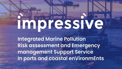
“Integrated Marine Pollution Risk assessment and Emergency management Support Service In ports and coastal enVironmEnts”
IMPRESSIVE project focuses in developing a universal-relocatable platform, based on CMEMS (Copernicus Marine Environment Monitoring Service, http://marine.copernicus.eu/) products, for real time management of marine pollution events in the wider area of EU harbors and their vicinities. The aim of the project is to combine EO monitoring, robotics and advanced numerical modeling at the harbor scale, where high risks for pollutant spills and waste waters arise due the large ship activity, traffic and refueling. The final product will be accompanied by an action protocol and will be tested & validated as an operational pilot in the ports of Las Palmas (Spain), Taranto (Italy) and Rafina (Greece).
Main goal:
Development of remotely operated sophisticated tools integrated with very high resolution models, Earth Observation (EO) products and other remote sensing products, for pollution control in harbours and surrounding coastal areas; a graduated system of prevention and response that will help to cope with water pollution alerts as quickly as possible.
Objectives:
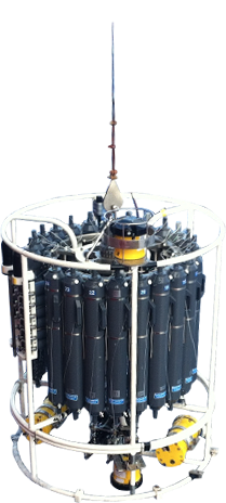
1. To integrate EO technologies (satellite, ASV, UAV) supported by positioning (maneuvering of autonomous vehicles) and ICT technologies.
2. To develop modules for down streaming satellite data and Copernicus Marine products for the ports of interest and for oil spills and other polluting events (waste waters) detection and alerts.
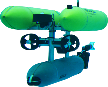
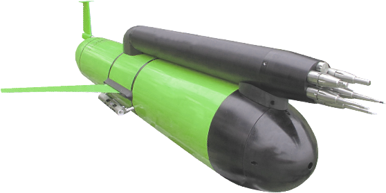
3. To build a validated drone-based (UAV) monitoring system and design/construction of two prototypes of Autonomous Surface Vehicles (ASV) for on-the-ground and air-based pollution monitoring.
4. To set-up high-resolution and 3D fully baroclinic hydrodynamic models at harbor scale based on downscaling up to metric resolution CMEMS products, such as the Iberian-Biscay-Ireland Regional Seas and Mediterranean seas.
5. To implement a marine pollution forecasting system in harbors (and their vicinity). Three harbors will be modelled as pilot areas: Port of Las Palmas (Spain), Port of Taranto (Italy), and Port of Rafina (Greece).
6. To develop risk mapping tools based on the integration of time series of remote sensing and pollution modelling products.
7. To design and develop a modular, service oriented high-level architecture platform to distribute project data.
8. To disseminate the IMPRESSIVE platform and to exploit the project outputs towards a targeted market, through interactions with End Users.
9. To involve suitable End Users so that the IMPRESSIVE platform meets their needs and requirements, supporting the reduction of pollutants, improving the quality of waters and providing greater access and information to citizens.
Duration: December 2018 – May 2021
Estimated total budget: 2,210,304.29 €
Project Website: http://impressive-project.eu

This project has received funding from the European Union’s Horizon 2020 research and innovation programme under grant agreement No 821922.